SWA 20230812
- Thomas Breckel

- Aug 10, 2023
- 1 min read
Updated: Aug 11, 2023
Update #1 (7:30 am on Friday, 11 August 2023).
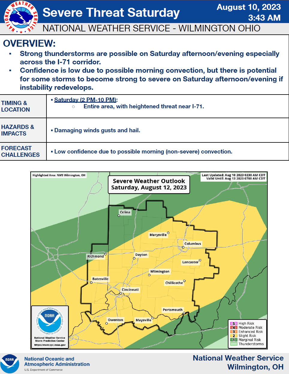
NWS continues its messaging of the potential for severe weather in our region for Saturday afternoon/evening, 12 August 2023. The forecasted impact location has shifted westward to the I-75 corridor and wording to suggest decreased potential for hail.

Review actions listed under keywords SEVERE, and POWER at https://www.cc-ema.org/prepare.
Stay Weather Aware!
[END]
- - - - - - - - - - - - - -
Initial Post: 7:30 am on Thursday, 10 August 2023
For the period of: Saturday, 12 August 2023
This is your Stay Weather Aware (SWA) message for Saturday, 12 August 2023. The NWS has published a OnePager indicating the potential for severe weather for our region this Saturday, 12 August 2023. The risk level SLIGHT is a 2 out of a risk level of 5 (highest).
It is too far out to know with any degree of certainty what weather we can expect, so stay aware if you are out and about for the afternoon and evening periods. Next update will be on Friday morning at 8 am.

[END]
- - - - - - - - - - - - - -
PNM - Prepare Now Message for events with forecasted high severity or impact (e.g. tornado potential, power outage potential, et cetera).
SWA - Stay Weather Aware message for events with the potential of some local impacts (e.g. localized power outage potential, et cetera).
HUM - Heads Up Message for events that are too far off for certainty, but may become significant local threats. Intent is to provide advanced heads up for those with household issues to begin preparing for the potential of impact (e.g. medical, livestock, et cetera).


Comments