

20240709 Beryl
- Thomas Breckel

- Jul 9, 2024
- 2 min read
Updated 3:30 pm on Tuesday, 9 July 2024.
Updates:
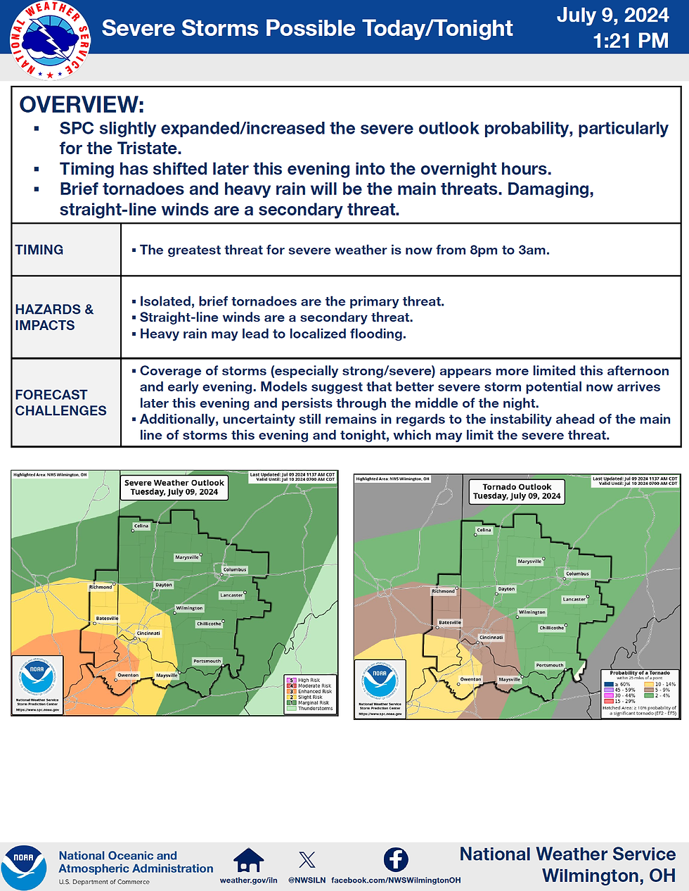
Storm Prediction Center (SPC) slightly expanded/increased the severe outlook probability, particularly for the Tristate.
Timing has shifted later this evening into the overnight hours (8 pm to 3 am).
Brief tornadoes and heavy rain will be the main threats. Damaging, straight-line winds are a secondary threat.
Updated NWS OnePager graphic:
[END]
- - - - - - - - - - - - -
Original Message
This is a heads-up message regarding the remnants of Hurricane Beryl as it passes through our region. The National Weather Service (NWS) has issued a OnePager forecasting the potential impacts to Southwest Ohio.
Overview:
Potential for severe weather this afternoon into early overnight.
Damaging winds, brief tornadoes, and heavy rains as the main threats.
Timing: Greatest threat timing between 5 pm to 2 am.
Forecast Challenges: The remnants of Beryl will move into the Ohio Valley late this afternoon and into the early overnight hours. There is moderate uncertainty about whether storms will develop this afternoon ahead of the main batch of storms expected later this evening. Additionally, there is uncertainty regarding the level of instability ahead of the main line of storms tonight, which may reduce the severity of the threat.
NWS OnePager graphic:

Storm Prediction Center Day 1 risk graphics.
MARGINAL Risk for severe weather.

Tornado Risk: 2% Tornado Risk for Clinton County.

Wind Risks: 5% Damaging Winds Risk for Clinton County.

NWS weather graph data:
Current as of 6:30 am Tuesday (9 July 2024).
Heat Index forecasted to reach 91F.
Wind gusts of up to 32 mph possible.
Chance of rain after 2 pm, likely after 8 pm to overnight.
Lightening/Thunder likely 9 pm to early Wednesday morning (chance after 3 pm).

[END]


Comments